The Morton Arboretum’s Chicago Region Trees Initiative and its partners are looking for a special kind of tree—the historic trees that helped map the state of Illinois.
In the early 1800s, surveyors used trees as landmarks to lay out the rectangular grid system of the new state of Illinois. These trees were known as “bearing trees”, a type of witness tree.
We want to know—how many of these trees survived as witnesses to history?
Find Bearing Trees Near You
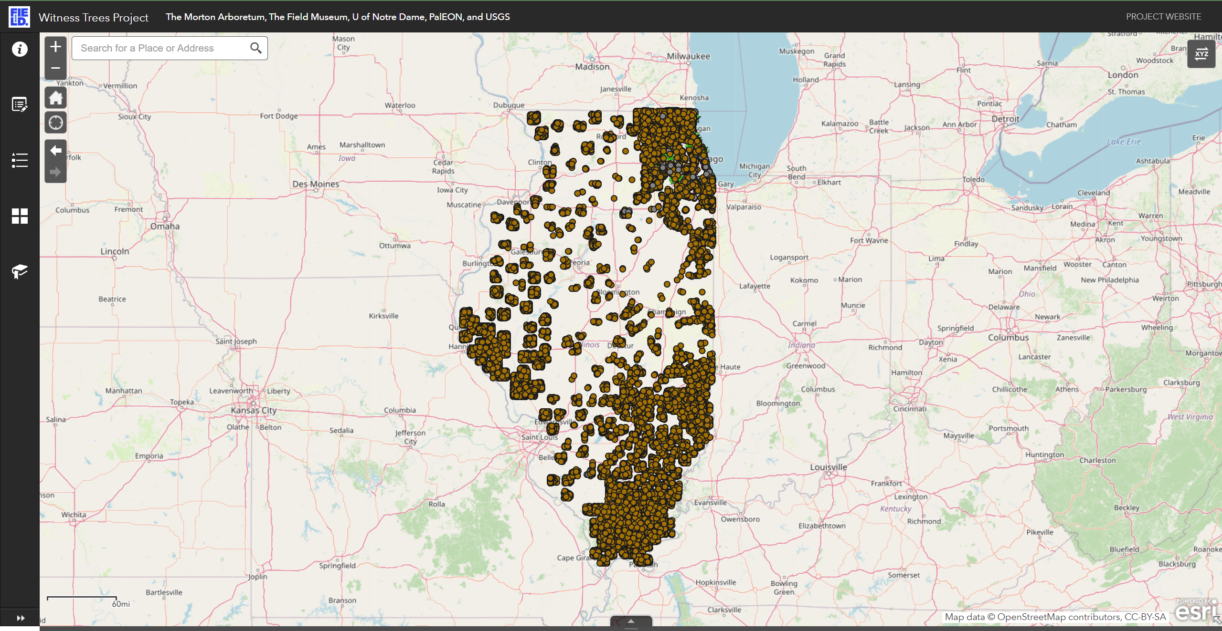
Use this interactive map to look for witness trees near you.
To help find and protect the witness trees of Illinois, all you need is a smartphone. You don’t need to know anything about trees, maps, or surveying to be part of this living history project.
We’re asking Illinois residents and visitors to visit the sites of bearing trees found on their property or on public lands and to record information about the remaining bearing trees. If there is no tree in that spot now or if a new tree is in its place, that’s also valuable for researchers to know; upload your observation anyway.
Please do not enter private property unless you have permission nor hike off maintained trails.
Historic Land Surveys in Illinois
Early in the 19th century, surveyors operating under the authority of the United States surveyor general began surveying lands that would eventually comprise the State of Illinois.
Surveyors moved across the land laying out a rectangular grid system known as the Public Land Survey system. The surveyors kept notes about the characteristics of the landscape and other “remarkable and permanent things.”
Where possible, they also identified three to four “bearing trees” at each corner and midpoint on the grid so that the spot could be found in the future. For each tree, they recorded its common name, location, and size and often marked or blazed the tree—these markings are rarely still visible. The surveyors also recorded similar information for any tree that fell directly on the line of their survey grid, called “line trees”.
Plat maps and field notebooks from these surveyors contain a wealth of information about what the landscape and regional forest was like at the time, when the majority of trees described were oak species.
Resources
Blog post on using the Illinois Public Land Survey Field Notes
Illinois plat maps from the 1800s
Illinois Public Land Survey data
Using the Public Land Survey data to understand our region’s early landscape
Vegetation of Northeastern Illinois in the 1800s
Where to Look for Bearing Trees
The interactive map below includes the locations of the original bearing trees and line trees as recorded by the surveyors in the 1800s.
Explore the interactive map.
Click on a point to see more information about the species and the size as noted by the surveyor. There is also a place to record your own observations, including whether or not the tree is still there, and to upload photos.
Most points on the map are accurate to about 15 feet, so be sure to look nearby for very large trees that might fit the bill. While we can’t confirm whether a tree is the exact bearing tree, we can use information about the size, species, and location to determine whether a tree is likely the mapped bearing tree.
Project Partners
The Morton Arboretum
The Field Museum
University of Notre Dame
The PalEON Project
US Geological Survey
Acknowledgements
The Public Land Survey System data for Northeastern Illinois was transcribed by Marlin Bowles and Jenny McBride of The Morton Arboretum.
All other Public Land Survey System data in Illinois was transcribed by 37 individuals from Jason McLachlan’s lab at the University of Notre Dame as part of the PalEON Project.
This work was funded by the National Science Foundation grant DEB 1241874 and the Upper Midwest and Great Lakes Landscape Conservation Cooperative.
